Higher detail
Capture the site-level resolution teams need for inspection and planning.
Dronnix turns controlled drone capture into georeferenced imagery, orthomosaics, 3D models, and datasets that infrastructure teams can use without chasing a fragmented workflow.
The challenge
Many industries depend on accurate geographic information to monitor assets, track changes, and plan operations.
Satellite imagery often lacks the resolution needed for detailed analysis, and inconsistent drone data collection can lead to unreliable results.
Capture the site-level resolution teams need for inspection and planning.
Use planned capture and review steps instead of one-off data collection.
Receive outputs that are easier to inspect, share, and act on.
What we do
Dronnix provides high precision drone mapping and geospatial data services using advanced mapping drones and sensors.
We capture georeferenced aerial imagery and convert it into 2D orthomosaic maps, 3D models, and structured geospatial datasets that help organizations better understand their infrastructure and environment.
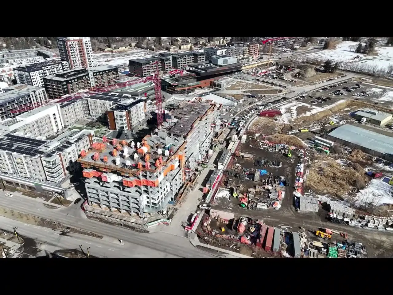
Our mapping services support solar infrastructure monitoring, construction progress tracking, agricultural analysis, and land mapping. Some organizations need the mapping data itself, while others use our analytical tools to extract deeper insights from the collected imagery.
How we operate
Define the area, use case, output type, and operational constraints before capture starts.
Run flight planning and data capture through a controlled process instead of relying on disconnected handoffs.
Convert imagery into mapped outputs, review quality, and prepare the dataset for delivery.
Provide the final outputs through a streamlined online ordering platform with transparent pricing.
Why it works
Unlike marketplace style drone platforms that rely on large networks of independent pilots, Dronnix manages the full workflow of each mission.
By combining AI driven data processing with locally operated drone systems in Alberta, Dronnix reduces operational complexity and processing time.
Our goal is simple: reliable mapping, clear delivery, and easier access to geospatial data for modern industries.
Team
Geospatial, AI, and drone operations experience in one delivery team.
Contact